Middle Wallop

Back to Country
ICAO Code EGVP/
Last Validated
City Middle Wallop
Position 51°08'56"N 001°34'08"W
Runway(s) 01/19, 02/20, 08/26, 13/31
Elevation 295 ft

General

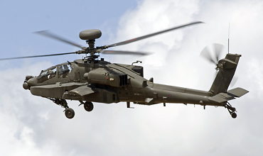
Middle Wallop is the main helicopter base, which houses the army flying school and some other tenants. It also known for its air shows, which used to be infamous for its cloud of helicopters at the end. Also, the excellent army air corps museum can be found here.

Layout

The airfield has two grass runway that tend to vary in exact layout over the years. The base recently received a paved runway, used by the Apaches; therefore it is attached to their ramp by a taxi way. Furthermore, some of the old macadam surface is still in situ along the perimeter.

The north side holds the five large AAC hangars and the ramps to the south of that. To the west, the AAC museum can be found. On the south side, the helicopters for the air show's fly-by used to be parked temporarily. This area is lower than the north side, but should not hold any aircraft. However, it is used for practice flight so it merits a visit, refer to spot 4.

Getting There

The airfield is just south of A343 which connects Salisbury to Andover.

Around the Airport

1AAC Museum

From the parking lot of the museum, the flying activities can be viewed. You have back light though, and the ramps are obscured by the museum and active hangars. However, the taxiway used by the T-67 Fireflies and Tutor T1s is insanely close, only between 15-50mm needed!

2North west side ramp view

The hangars and ramp of the DEFTS's Fireflies are close to the A343. Walking past the fence along A343 will yield some of the hangar's content.

3East side ramp view

The Apaches can be seen in the distance on the ramp from the road running past the eastern side of the airfield. Only under ideal lighting conditions, some will be readable. With the new runway 04/22 in place, Apaches do perform approaches to runway 22, but you need to be lucky to get them at the correct angle, height and distance.

4South side view & slopes

From spot 3, go south and make a left. After about 1.3 km you can go right into a dead end that leads to a crash gate. Be sure to park your car out of the way. Here you can walk along the edge of the farm land to the right. There are some slopes which are used by practising helicopters. You can go right as well. The fence is about 80 cm high, but if you step over it you will be on military property! Good for photography if the helicopters are active. Please respect the local farm land and if the farmer asks you to leave, please do so.

With the advent of the new 'runway' 04/22, you can catch an approaching Apache with some luck! (310mm, Spot 3, Jaco Haasnoot)

The south side of the base is actively used as well and provides great photographic opportunities. (200mm, Spot 4, Jaco Haasnoot)

Frequencies

372.625 / 118.600Tower
275.400 / 312.675Radar
364.825Radar
312.000Approach

Based Operators

Army Air Corps Historic Flight (AACHF)various
667(D&T)sqGazelle AH1,
Lynx AH7
668sqSquirrel HT2
670sqSquirrel HT2
671sqGazelle AH1,
Lynx AH7,
Bell 212
673(AHTU)sqApache AH1
DEFTS Army Grading FltT-67 Mk2,
Tutor T1

Preserved

WZ724Auster AOP9, gate
XT638/NScout AH1, gate
XT827/'XT123/D'Sioux AH1, gate
XX392Gazelle AH1, HQ Directorate of Army Aviation
not visible from outside?
Museum of Army Flyingvarious

Other Airfields

Aberdeen-Dyce  
Barkston Heath (RAF)
Benson (RAF)  
Biggin Hill  
Birmingham
Boscombe Down (QinetiQ)
Bournemouth (Hurn)  
Bristol - Lulsgate  
Brize Norton (RAF)  
Cambridge
Cardiff (Rhoose)  
Chester (Hawarden)  
Coningsby (RAF)
Cranwell (RAF)  
Culdrose (RNAS)  
Durham Tees Valley (Teesside)  
East Midlands  
Edinburgh  
Fairford (RAF)  
Farnborough
Fife (Glenrothes)
Glasgow - Prestwick  
Glasgow Intl (Abbotsinch)
Lakenheath (RAF)  
Leeds Bradford  
Leeming (RAF)  
Leuchars  
London - City  
London - Gatwick  
London - Heathrow
London - Luton  
London - Stansted
Lossiemouth (RAF)  
Manchester (Ringway)
Marham (RAF)  
Middle Wallop  
Mildenhall (RAF)
Newcastle  
Northolt (RAF)  
Norwich  
Odiham (RAF)  
Southampton - Eastleigh  
Southend
St. Mawgan - Newquay Cornwall Airport  
Syerston (RAF)  
Valley (RAF) - Anglesey
Waddington (RAF)
Wales Low Flying Area 7
Warton
Wattisham (RAF)  
Wittering (RAF)  
Yeovilton (RNAS)  

Send Updates

Do you have updates? Or is something not listed correctly? Please let us know! You can help us and other spotters with your information.
Invalid Input
Invalid Input

0/255

Invalid Input
Invalid Input

Subscribe to Scramble

As a member you get access to all our
premium content and benefits learn more